Previous
2009|Blue roses were marketed, and the pursuit to improve the blue color continued
2025.12.22
Sustainability Water science Story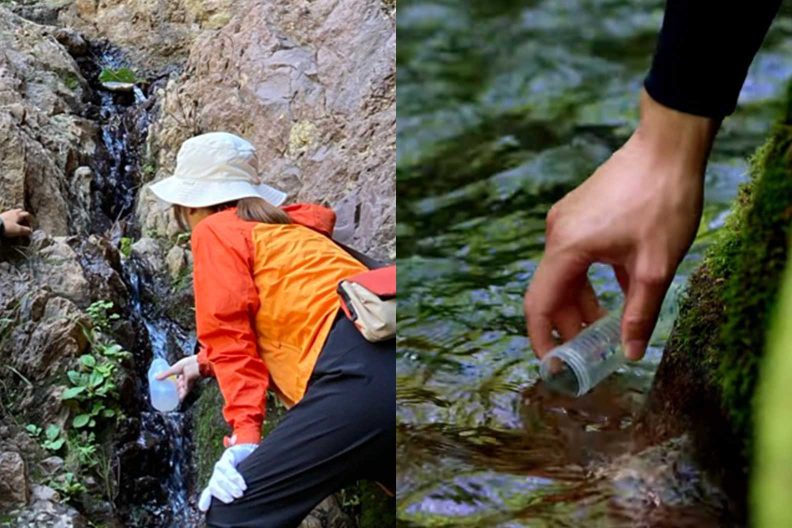
The Institute for Water Science continues to take on the challenge of visualizing the movement of unseen groundwater through advanced computer simulations and improving our ability to predict its flow.
This article is a re-edited version of an article that appeared on our corporate website in 2019. Job titles, department names, and photos are current as of the time of publication (2019) and may differ from the present.
Suntory continues to advance research aimed at understanding the invisible movement of groundwater to ensure the sustainable use of this precious resource. We collect detailed data on rainfall, snowfall, topography, geology, springs, and rivers across our water source areas, and use numerical modeling to visualize groundwater behavior. Field-based investigations, particularly those centered on spring monitoring, play a key role in improving the accuracy of these predictions. Through this research, we estimate where and how much groundwater is naturally replenished. These insights support long-term sustainability initiatives, including our “Natural Water Sanctuary” program, which is designed with a 100-year perspective.
The natural mineral water used for Suntory Tennensui as well as to brew The Premium Malt’s and our other beer products is withdrawn from ground water sources in natural environments across Japan. It is never processed and contains zero artificially-added minerals for a delicious, purely natural taste.
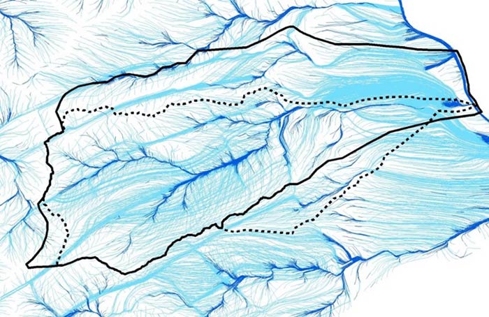
Groundwater have been slowly percolating through geological layers for vast amounts of time. If we want to conserve these precious water sources, it is essential that we know how it is flowing and where—from the moment it soaks into the ground as rainfall or snowfall to the moment it reaches our bottling plants. But because groundwater run deep in the earth, we can’t see the way they flow directly, as we can with rivers. The Institute for Water Science is using computer simulation models to help track these hidden groundwater system. Our researchers are carefully collecting data on climate, topography, and geography—as we as on springs, rivers, and other water sources—and then numerically processing it in order to estimate the groundwater flows.
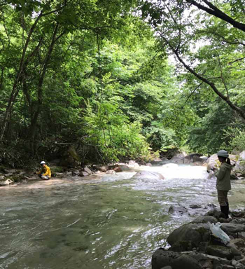
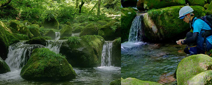
These precision simulations require highly accurate data on-site. Springs are particularly important for identifying the groundwater flow system, as they are where the groundwater comes up through the surface. We have traversed every inch of the water source areas that recharge the Minami Alps Hakushu Water Plant and discovered nearly a hundred springs so far. Mapping these locations and matching them to the computer-predicted spring locations has allowed us to conduct a detailed validation process. Because water is constantly changing form in the natural environment, we will continue with our steady on-site investigations and observations.
Once we know where groundwater is flowing, we can estimate where and in what quantities it will be recharged. Comprehensive analysis of these factors will in turn help us in a variety of initiatives aimed at sustainable water use—among them 100-year forest and soil conservation activities like the Suntory Natural Water Sanctuaries project.