Visualizing Groundwater Flow
Cutting-Edge Simulation Using Detailed Forest Surveys
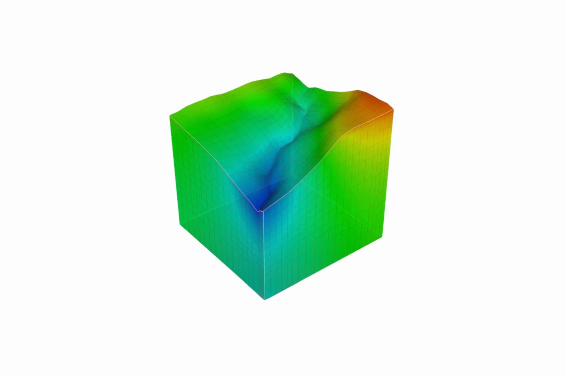
Our Natural Water Sanctuaries use a modeling system called GETFLOWS to simulate the movement of groundwater throughout their entire mountain catchment areas.
As a computer model of water circulation, GETFLOWS is typically fed data on topography, geology, meteorology, and other information held by national and local governments, which it then uses to perform calculations. The results of these calculations are publicly available, allowing anyone to view the general flow of groundwater across Japan.
To further enhance this model, we acquire our own data from aerial laser scanning to obtain detailed topographical information of each of our Natural Water Sanctuaries. We also continuously integrate local data on geology, climate conditions, river flow, and groundwater levels into the model, making each simulated mountain catchment area increasingly closer to reality. Additionally, we replicate past rainfall patterns within the model, by adjusting the simulated river flow and groundwater levels based on actual past observations.
This model not only allows us to ascertain current groundwater levels and flow patterns, but also helps predict the effects of forest management practices and future climate change on groundwater. It serves as a reference guide for our water usage and forest conservation efforts.
Moving forward, we will continue refining the model through ongoing alignment with the results of our forest surveys, bringing it ever closer to reality.
A Trial to Observe Groundwater: GETFLOWS (Japanese Only)
Experts involved in this Initiative

Geosphere Environmental Technology Corporation

Tomochika Tokunaga
Professor, The University of Tokyo

Maki Tsujimura
Professor, University of Tsukuba
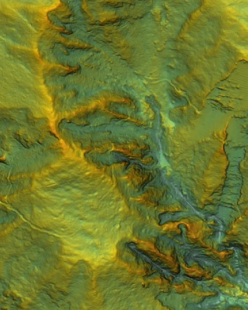
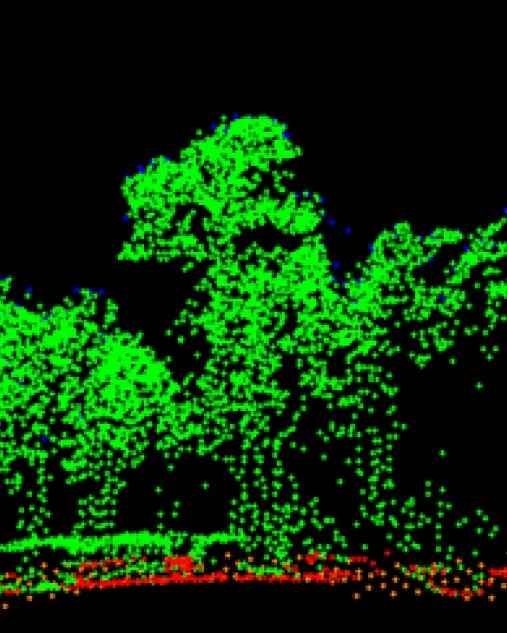
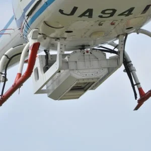
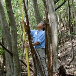
Aerial Laser Scanning
By using aerial laser scanning, we can obtain highly detailed topographical data that is not visible in conventional topographic maps or aerial photographs. This method also allows us to measure tree height and density in our forests.
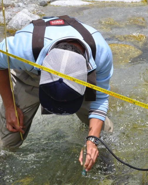
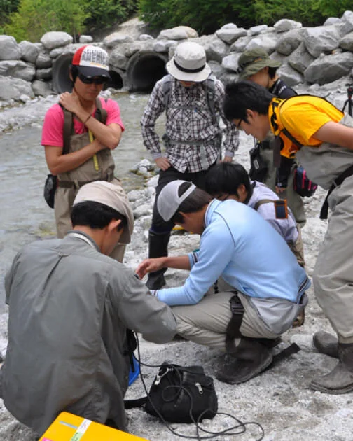
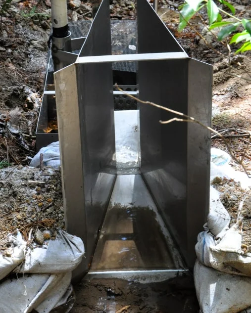
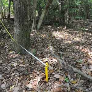
River Flow Surveys
We conduct flow rate surveys across the upstream and downstream sections of our rivers. Along with rainfall data from the watershed, the results provide essential information for understanding groundwater movement.
Experts involved in this Initiative
Maki Tsujimura
Professor, University of Tsukuba
Tomochika Tokunaga
Professor, The University of Tokyo
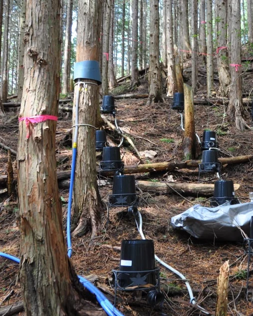
Forest Rainfall and Spring Flow Monitoring
We measure rainfall inside and outside the forest, as well as stemflow — the water that flows down tree trunks. This helps us analyze how forest conditions influence the volume of spring runoff.
Experts involved in this Initiative

Yuichi Onda
Professor, University of Tsukuba
Learn about the attention to detail in tree planting
Research Conducted with Experts
By combining field investigations with simulations, we ascertain the current health of the forest and forecast its future.

Planning Based on Forest Surveys
Vision Development
In our Natural Water Sanctuaries, conservation and restoration efforts are taken with a long-term perspective spanning 30 to 100 years. The foundation of this effort is the development of a vision.
Since forest conditions vary significantly from one location to another, thorough surveys are conducted to examine both past developments and the current situations. The surveys involve a wide range of tools and information, including topographic maps, aerial photographs, existing vegetation classifications, and the characteristics of individual plant communities*.
Based on the survey results, discussions are held with vegetation consultants, forestry experts, and other specialists to identify issues for each plant community. Subsequently, multiple solutions are proposed for each identified issue, and maintenance policies are determined accordingly. By updating each vision every 5 to 10 years, the Sanctuaries undergo continuous evaluation and improvement.
A community is a group of plants that inhabit the same location.
Experts involved in this Initiative

Regional Environmental Planning, Inc.

Institute of Rural and Urban Ecology Co., Ltd.

MORISHO LLC

AI-Shokubutsu Landscape Planning Office
Implementation of Forest Management Plans
We carry out restoration and maintenance activities in collaboration with professionals from various fields.

Improvement Through Ongoing Surveys
The plants and animals living in forests are constantly changing. In our Natural Water Sanctuaries, ongoing surveys are conducted to inform continuous improvements.
Examples of Our Activities
When working with nature, things don't always go as planned. That's why ongoing surveys after forest maintenance are crucial. Sometimes, results exceed expectations, while other times, efforts end in complete failure. Here are some examples of challenges and discoveries encountered during our activities.
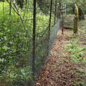
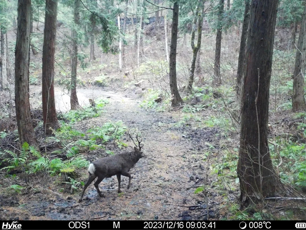
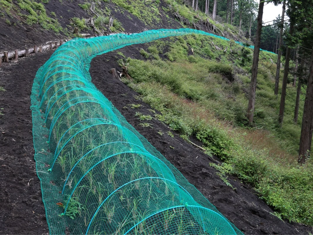
These Deer Weren't Here Last Year
In our Natural Water Sanctuary Okudaisen, 2 to 3 meters of snow accumulates during winter. Because of this, deer had never been seen in the area until recently. However, signs of deer feeding on grass and shrubs started to appear. In response, cameras were immediately set up, revealing a significant presence of deer.
The original maintenance plan for our Natural Water Sanctuary Okudaisen was designed for a forest without deer. Until recently, this sanctuary stood out as an exceptional example where biodiversity thrived and maintenance results were highly effective.
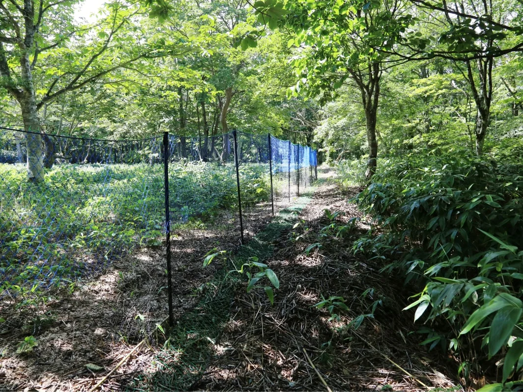
Unfortunately, the unexpected arrival of deer meant the plan had to be completely revised. The first step was to fence off key areas. However, standard metal fences would be damaged as melting snowpacks move during the spring thaw. To address this, we are taking an emergency measure of installing a resin net immediately after the snow begins to melt, and then laying the net flat on the ground when the snow starts to accumulate.
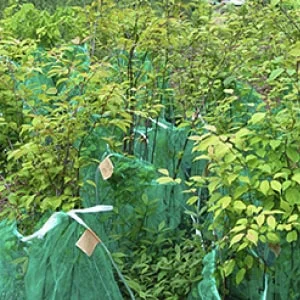
A Mountain Made of Pumice?
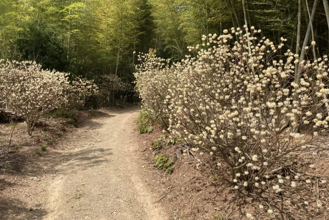
When the agreement was signed to create our Natural Water Sanctuary Shizuoka Oyama, the most surprising aspect of the forest management challenge was the fragility of the mountainside. The majority of the existing logging roads had been severely eroded by heavy rains, leaving deep trenches throughout.
In fact, this mountain is composed of alternating layers of volcanic ash from past eruptions of Mount Fuji and small pumice stones called scoria. When roads or other clear-cuts expose the ground, the pumice layer is quickly eroded by water.
As a result, we decided to turn unnecessary logging roads back into forest. Unfortunately, these areas are also frequented by many deer. So, on the flat roadbeds we planted mitsumata (Oriental paperbush) and susuki (Japanese silver grass), which are less palatable to deer. Although susuki is generally disliked by deer, for some reason they like to pull out the young plants. So, we are covering them with agricultural bird netting until they are well-established. The broadleaf trees planted on one side are being protected as individual trees.
New Discoveries During Forest Management
As we continue to repeat our process of R-PDCA (research, plan, do, check, and act), we sometimes make unexpected discoveries. Here are some of the surprising discoveries we have made about wildlife during our forest management activities.
Deer Feeding Almost Exclusively on Fallen Leaves During Winter!
As part of our Natural Water Sanctuary Project Chichibu with the Univ. of Tokyo, we conducted DNA analysis of deer droppings to investigate what they eat in different seasons. The results were astonishing.
During winter, the primary food source for deer turned out to be maples and dogwoods. However, both of these tree types are deciduous. This means in winter, there are no green leaves available to eat. Later, using footage from fixed-point cameras we confirmed that deer herds are feeding on fallen leaves. As you can see, the deer were in good condition and showed no signs of malnutrition.
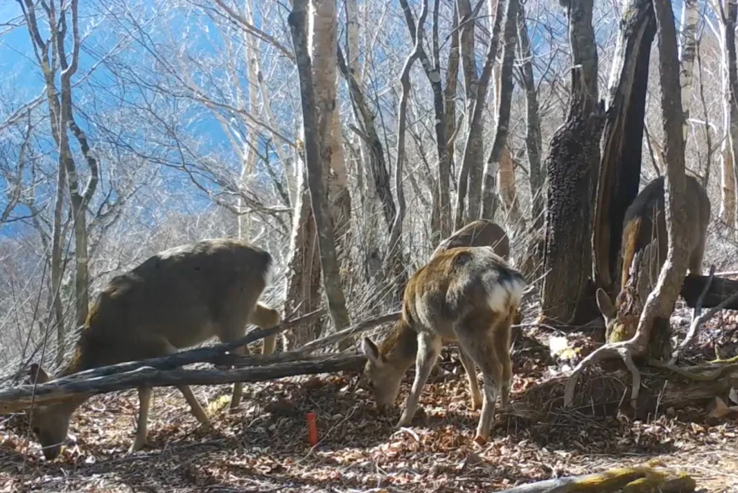
If deer can survive on fallen leaves, then their food resources are virtually limitless. This discovery invalidates the once-optimistic assumption that if deer eat up all the undergrowth, they will eventually starve and their numbers will decline. We are now developing new strategies to protect forest biodiversity.
Experts involved in this Initiative

Hirao Toshihide
Lecturer, The University of Tokyo
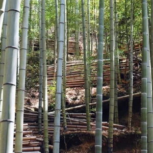
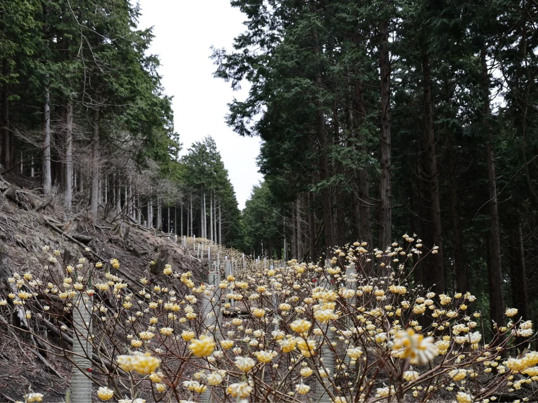
A Possible Solution for Invasive Bamboo?
In our Natural Water Sanctuary Tennozan, a logging road was built alongside a bamboo grove. To protect the road’s embankments (norimen*1), we planted mitsumata (Oriental paperbush) —a species that deer do not eat.
Then, something unexpected happened. Along the sides of the road where mitsumata was densely planted, bamboo shoots stopped sprouting. It appears that mitsumata has an allelopathic effect*2 that inhibits bamboo roots. If this proves correct, it could be a breakthrough solution for controlling invasive bamboo across Japan.
- Norimen refers to the slopes created on both sides of a logging road.
- Allelopathy is the phenomenon where chemicals released by one plant influence the growth of other plants or microorganisms.
 Home
Home Initiative Policy and Structure
 Living Things in the Natural Water Sanctuaries
 Dedication to Water
 Natural Water Sanctuaries
  Natural Water
  Initiative History